
Wildfire Risk Assessment
- 11
- Apr
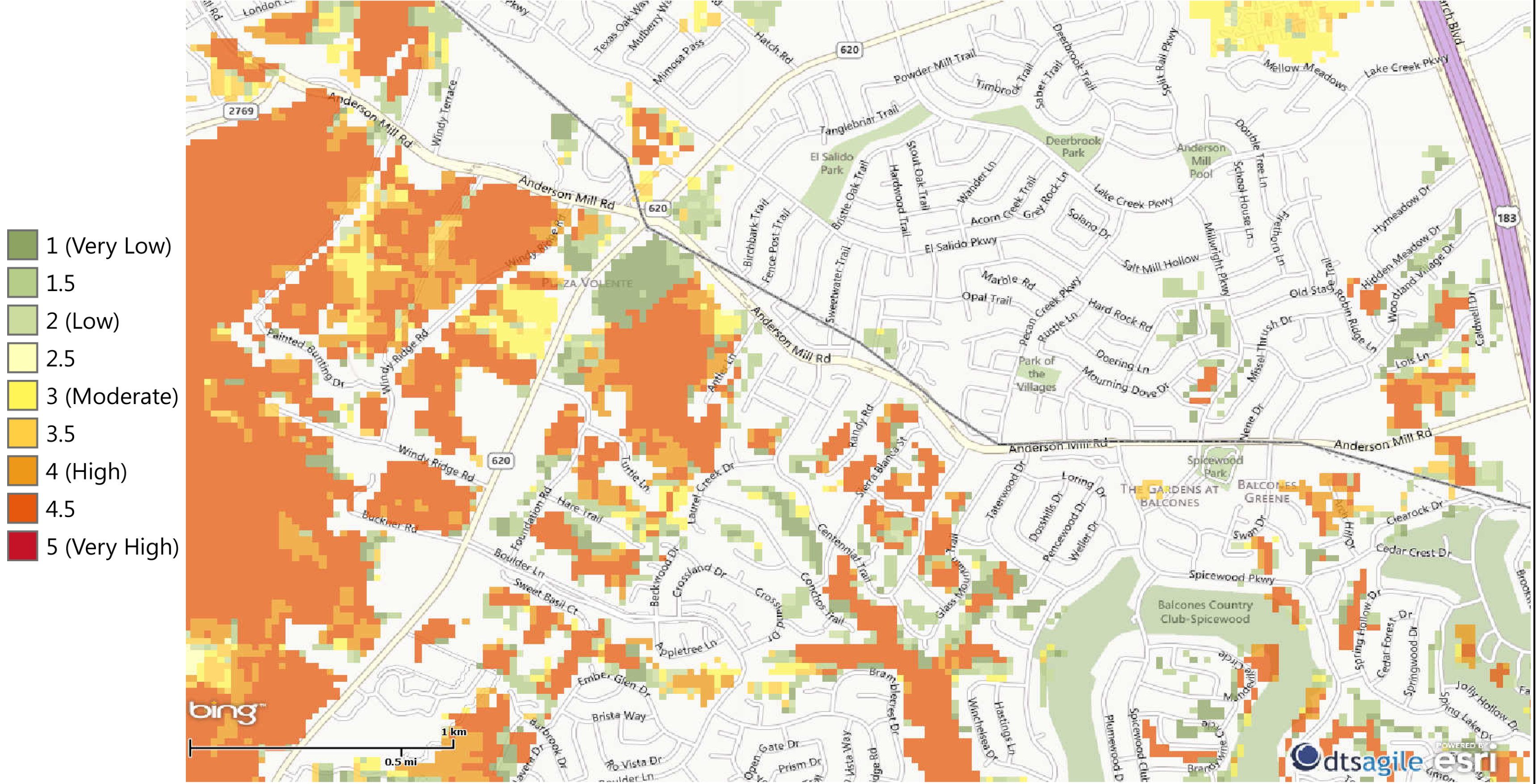
The Texas A&M Forest Service provides a website that helps create awareness about wildfire issues across the state of Texas. Their website is located at www.texaswildfirerisk.com and contains a nice graphical map of all areas in Texas with an overlay of wildfire risk areas. The map allows you to zoom in to our neighborhood and view surrounding areas that have been deemed a potential wildfire threat. Once you zoom in, you can click the “What’s Your Risk” tab on the left sidebar which gives you the ability to “Draw Point” on the map to indicate the approximate position of your house. After clicking your house location, the software generates a 1000 foot radius around your home and calculates your home’s wildfire risk. Try it out!
My house is located on Centennial Trail near Anderson Mill Road, but I am in close proximity to the wooded areas at our park, the water drainage area as well as other heavily tree’d areas in Laurel Canyon. My house gets a wildfire risk assessment of Moderate to High which is not exactly comforting.
Is there anything we can do to help reduce this risk? HOA President Pat O’Rourke discussed this issue at the 2013 Annual HOA meeting. He has been getting bids from local companies to come and clear out the dead trees in the wooded areas surrounding our neighborhood as well as working in his spare time to cut down dead brush and trees in the drainage area near his house. We could all pitch in and have a productive afternoon or two, to help reduce all of our wildfire risks while enjoying the fresh outdoors before the heat of summer arrives. If you are interested in helping with this activity, please contact Pat at president@estatesofbrentwood.org.
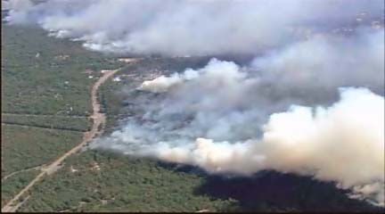
Photo of Steiner Ranch wildfire in 2011.
